
The U.S. State Department approved the Foreign Military Sale of Hawkeye 360 to India. The approved package includes RF sensors, analytics software, system integration support, and training modules. The total value of this package stands at $131 million. This sale boosts India’s maritime surveillance capabilities in the Indo-Pacific region.

Hawkeye 360 Provides India With Real-Time Maritime Monitoring
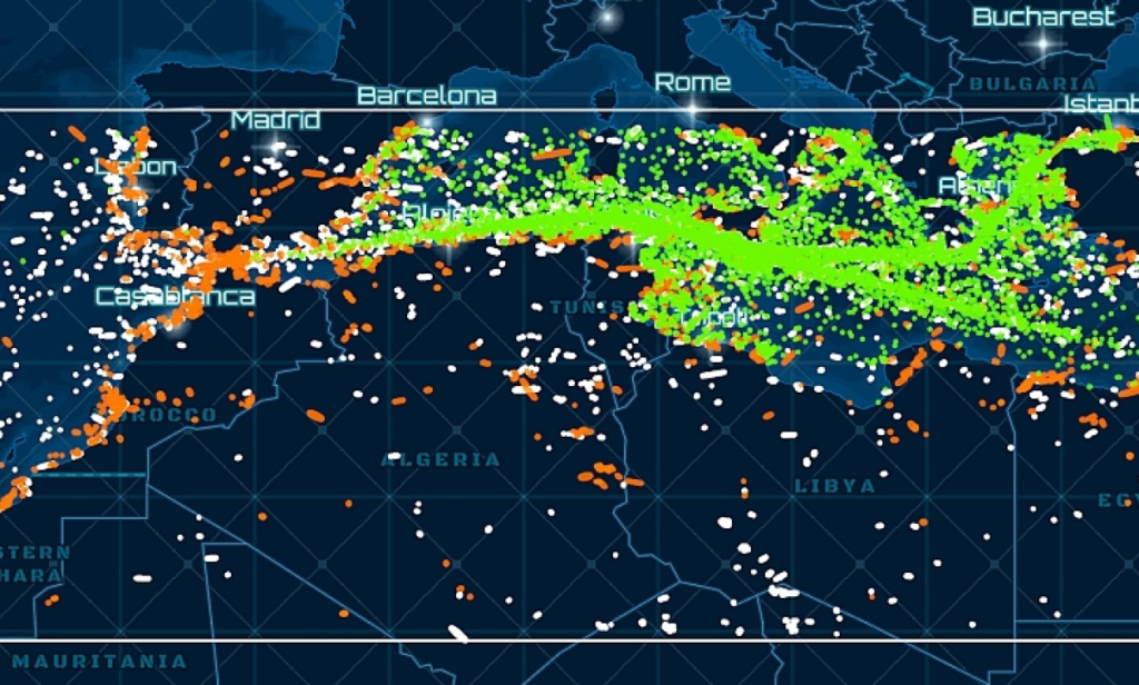
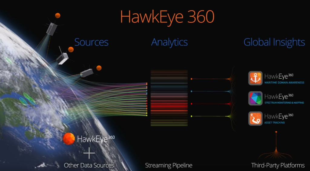
Hawkeye 360 deploys a constellation of small satellites in Low Earth Orbit. These satellites detect and geolocate radio frequency (RF) emissions. They track communication signals from ships, aircraft, vehicles, and coastal systems. The system allows India to monitor large ocean zones in real-time. It increases awareness and response in maritime operations.
India Strengthens Indo-Pacific Maritime Control Using Hawkeye
The system detects ships that turn off AIS to evade tracking. It locates RF sources from shipboard radars and radios. Indian forces can now identify illegal fishing, smuggling, and surveillance. This detection allows quicker decisions and better maritime domain control. India now gains deeper visibility across its Exclusive Economic Zone.
Multi-Layered Surveillance Enhances Hawkeye 360 Capabilities
Hawkeye 360 forms the RF layer in a larger ISR system. This system uses Electro-Optical (EO), Infrared (IR), and Synthetic Aperture Radar (SAR) as additional layers. Each layer improves detection, verification, and classification of threats.
EO Imaging Confirms RF-Based Vessel Locations
EO satellites capture high-resolution daytime imagery. Analysts use these images to verify RF detections visually. The EO layer works best in clear daylight conditions.
IR Sensors Detect Heat Signatures From Vessels
Infrared sensors identify thermal emissions from engines and exhausts. This helps track ships at night or under camouflage. The IR layer works in low-visibility conditions.
SAR Imaging Sees Through Clouds and Darkness
SAR satellites capture radar-based images regardless of weather. This layer confirms ship size, speed, and location. SAR adds vital detail during nighttime or storm conditions.

Hawkeye 360 Features and Specifications
- Detects: RF signals from ships, aircraft, and ground emitters.
- Coverage: Global, with frequent revisit capability.
- Accuracy: Geolocates signals within a five-kilometer radius.
- Architecture: Small satellite clusters in coordinated orbits.
- Technology: AI-driven analytics for signal classification.
This system combines speed, precision, and adaptability. It works continuously across all weather and time conditions. Analysts gain a complete situational view using RF intelligence.
Hawkeye Operational Scenarios
Detecting Dark Vessels
Ships disable AIS to avoid detection. Hawkeye identifies them using emitted RF signals. It tracks movement despite these countermeasures.
Monitoring Chokepoints and Borders
India monitors sensitive zones and coastal chokepoints. RF alerts provide early warning about illegal or suspicious activity.
Disaster Relief and Rescue Operations
Hawkeye 360 locates distress signals during maritime accidents. It guides rescue teams faster and improves emergency response.
Hawkeye 360 Advances India’s Indo-Pacific Strategy
India now operates with higher maritime awareness and faster reaction times. Hawkeye integrates seamlessly with naval command systems. It supports national security, border safety, and regional stability. The system delivers vital intelligence to counter evolving maritime threats.


good
Is this a one-time payment of 131 million dollars or recurring?